


The mountains are calling, so they say. Mountains possess the awe to dare you to conquer them or to appreciate them from afar. Remote locations also hold appeal, for those either searching for a respite from the everyday craziness or a permanent home of solitude.
A mountain range is defined as “a series of mountains or mountain ridges closely related in position and direction” (Merriam-Webster). What, then, does “remote mountain range” actually mean? Literally, it means a series of mountains that is far from the main centers of population.
Even though some outdoorsmen, backpackers, and geological enthusiasts have presented more specific and limited parameters for this straightforward phenomenon, the effect of those beckoning cliffs is the same: awe and inspiration.
Let’s discover the fifteen most remote mountain ranges on the planet.
1. Maunga Terevaka
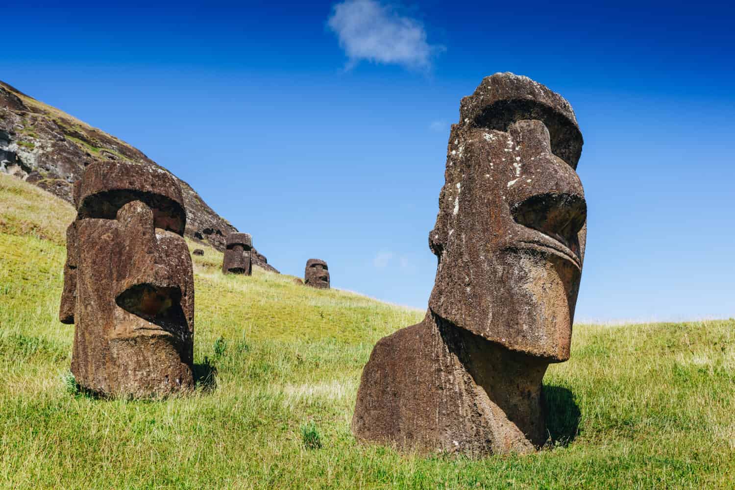
At 507 meters (1664 feet) high, Terekava is the tallest, youngest, and largest of the three chief volcanoes that make up Easter Island, Rapa Nui, 2,200 miles west of Chile. The mountain contains several distinctive craters and caves on its slopes, and in certain areas, visitors can get a glimpse of the ceremonial ruins of the Rapa Nui culture.
Most visitors to Terekava travel the mountain by horseback, but it is accessible by foot. The official trail is a 5.9-mile out-and-back trail that is considered moderately challenging. For most, it takes about three hours to hike.
2. Khüiten Peak
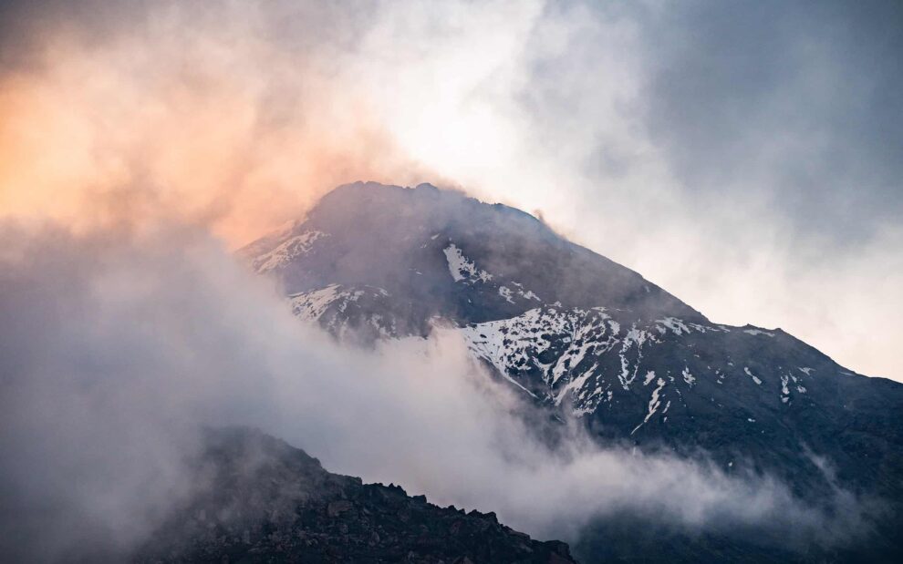
One of the least accessible mountains on earth, Mount Khuiten lies at the core of Mongolia’s Altai Tavan Bogd (“Five Holy Peaks”). At 4,374 meters (14,350 feet) elevation, Khuiten is Mongolia’s highest mountain. Its name translates to “cold peak” in Mongolian; the name fits. In July, the average high is 40°(F), and the average low is 12°. In January, those numbers plunge to -26° and -50°.
Mount Khüiten is located in the Altai Tavan Bogd National Park, a scenic area featuring snow-capped mountains and lush, green valleys. Altai is a highly protected park, so visitors can regularly see bears, lynxes, and the endangered snow leopard.
The best time to climb Khüiten Peak is obviously in the summer months, between June and August. The entire hike can take anywhere from 10 to 15 days, depending on acclimation and amount and time of stops along the path. Logistically, the time and price that it takes to get to this mountain range are huge factors in considering this destination.
3. Kilimanjaro
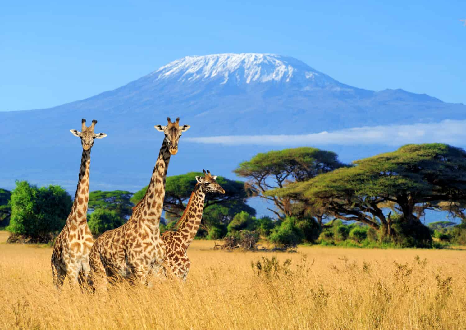
The tallest freestanding mountain in the world, Kilimanjaro stands at an elevation of 5,895 meters (19,341 feet). On the northern border of Tanzania in Africa, it is approximately 200 miles south of the equator.
Numerous guide outfits exist for those wanting to brave Kilimanjaro, and it takes anywhere from five to 12 days to hike it, depending on acclimation, pace, and rest breaks. The altitude and rate of ascent are the biggest obstacles when climbing this mountain.
Kilimanjaro is located near the town of Moshi, and plenty of activities await those who want to visit but not climb, such as day trips and the Marangu Falls.
4. Satopanth
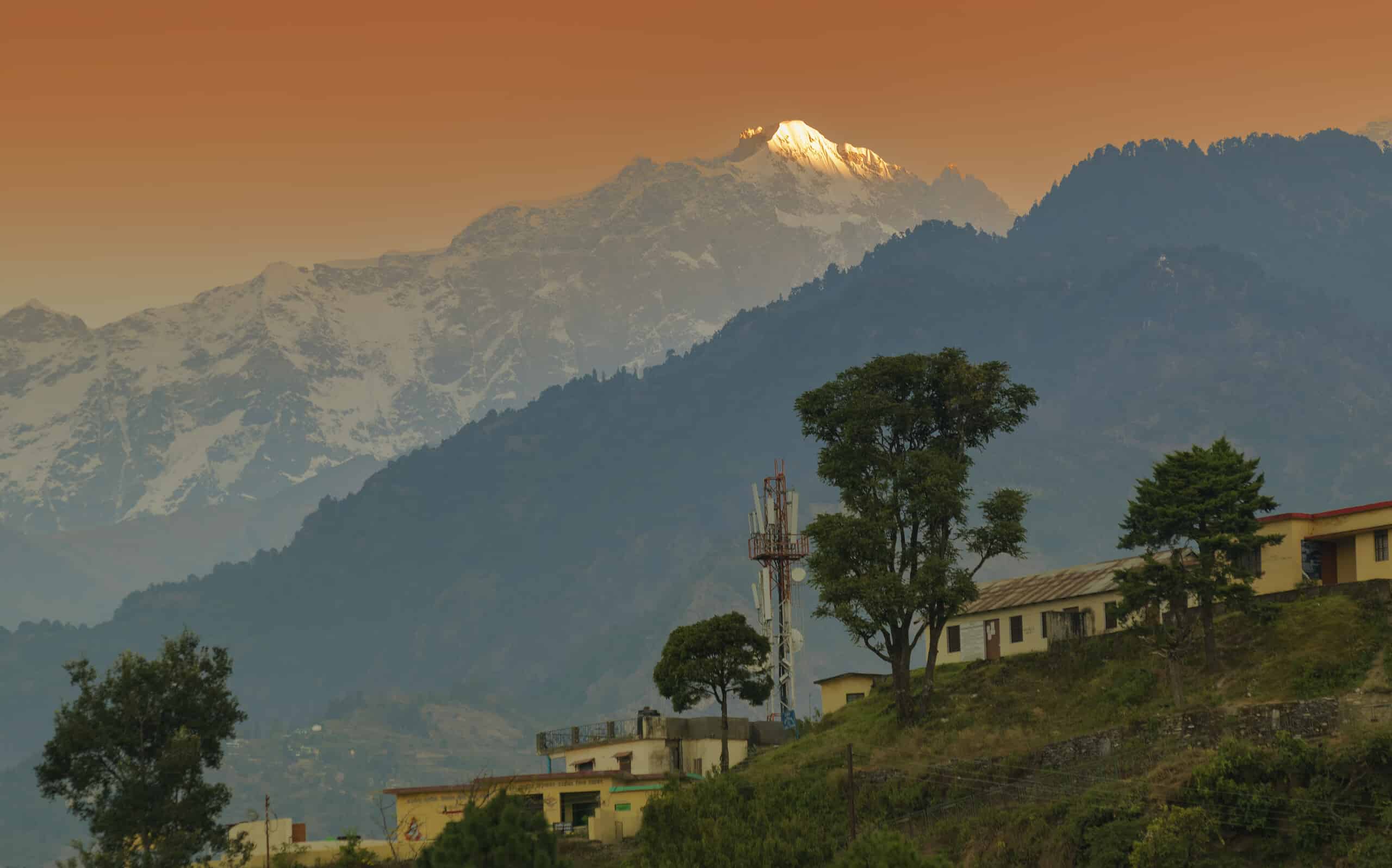
In the Garhwal range of the Himalayas in India, Satopanth lies at an elevation of 7,075 meters (23,211 feet). In the local dialect, the mountain’s name means “truth path.” Most expedition groups plan about three weeks total for this trek, but shorter hikes are also available.
The complex and technical hike traverses over glaciers, with the summit approach over a knife-edged ridge. The Satopanth Lake hike offers a more moderate trek and takes about seven days.
5. Aconcagua
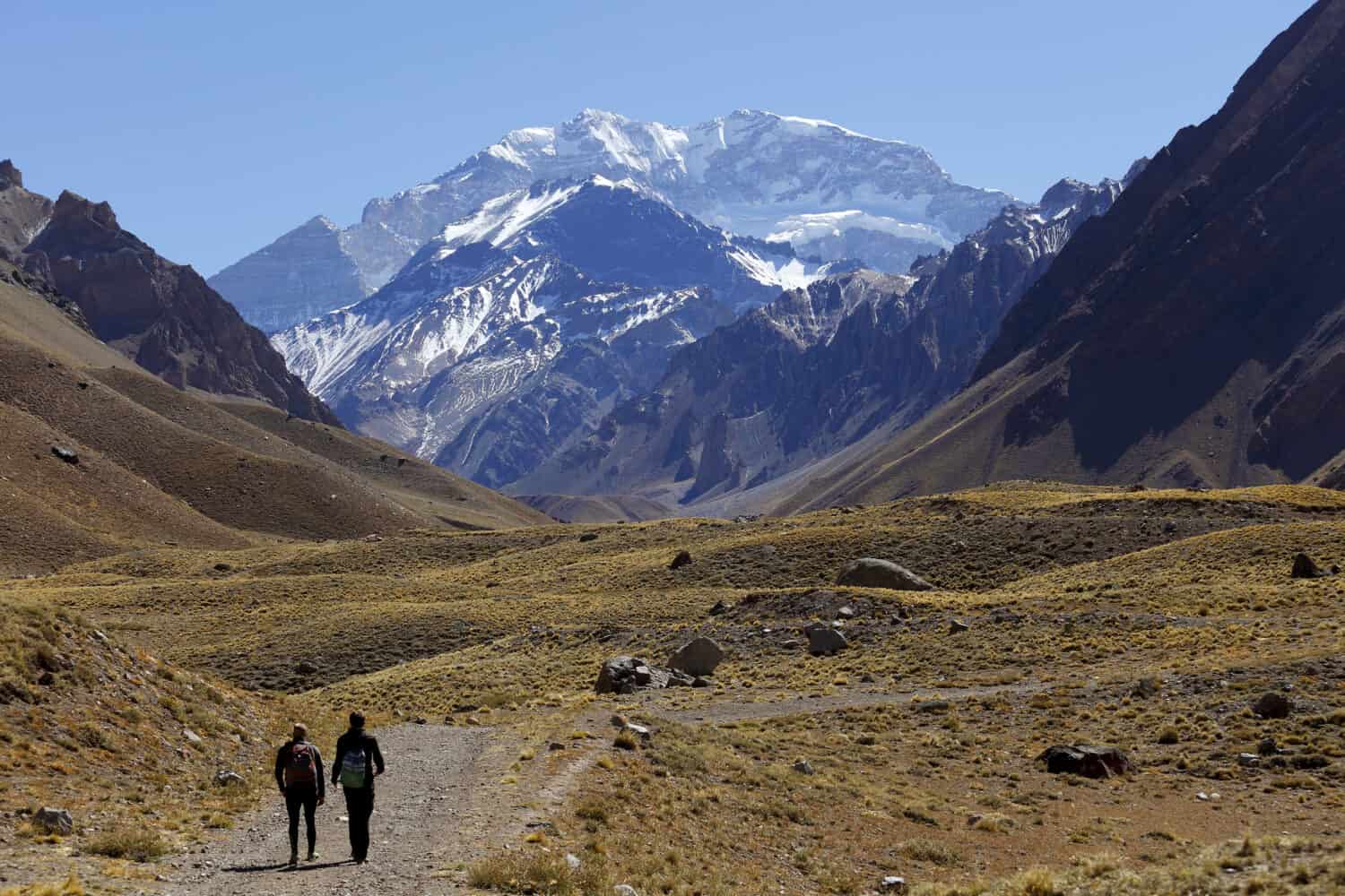
Part of the Andes Mountain range in Mendoza Province, Argentina, Aconcagua’s elevation is 6,962 meters (22,941 feet). It is the highest mountain in the Americas, outside Asia, and in both the Western and Southern hemispheres. It is surrounded by the Valle de las Vacas (“cow valley”) to its east and north, and the Valle de Los Horcones (“forked valley”) to its west and south.
Only 30-35% of climbers successfully reach Aconcagua’s summit. Many experts even say that this monstrous climb is more difficult than Kilimanjaro. Most expeditions are around 21 days long, with time for adequate acclimation and several summit attempts. Experts highly recommend that only professional trekkers attempt this mountain without a guide.
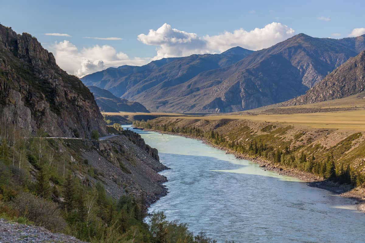
6. Belukha
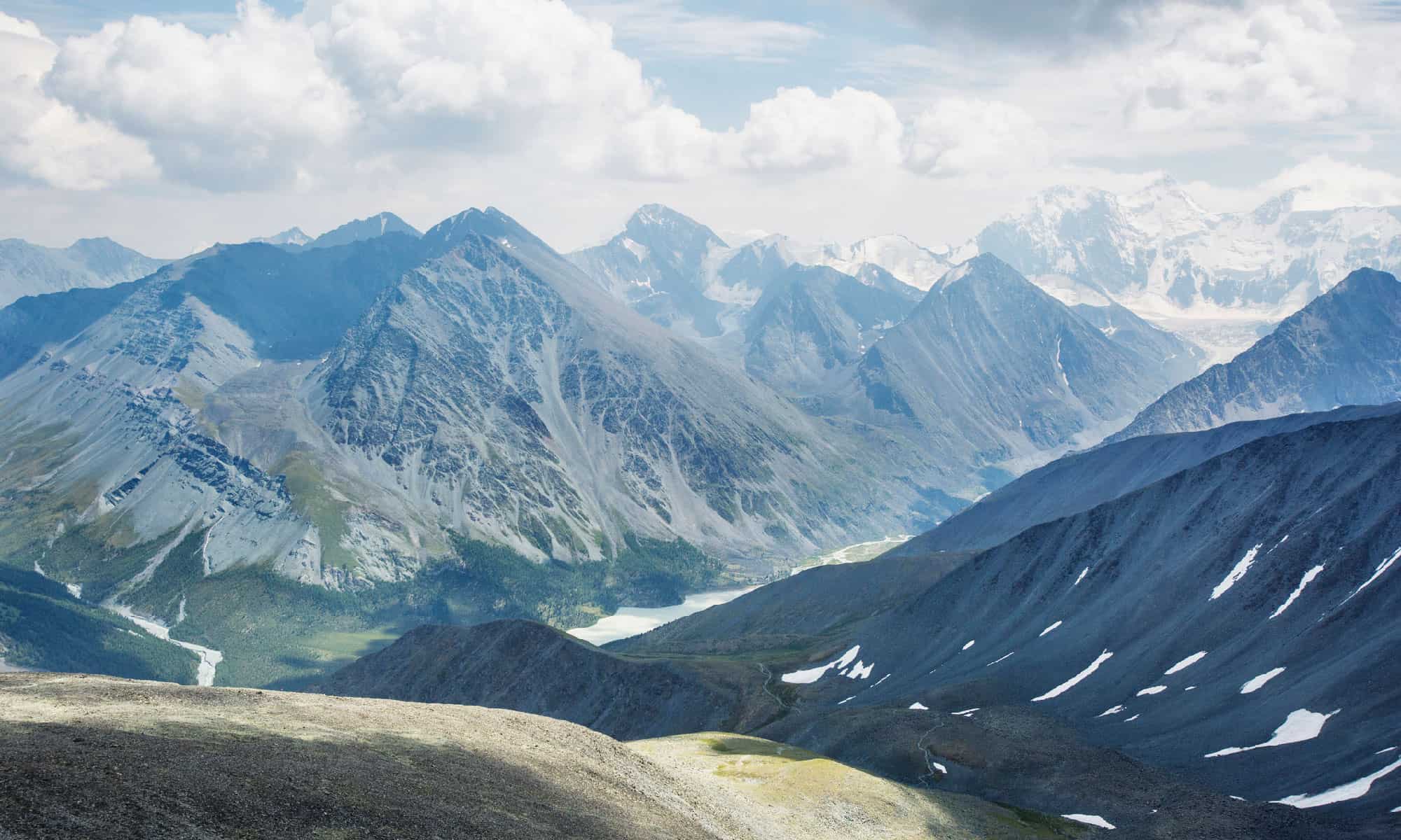
Located in the Katun Mountains, Mount Belukha is the highest peak of the Altai Mountains in Russia. At an elevation of 4,506 meters (14,783 feet), Belukha contains three peaks that rise above the borders of both Russia and Kazakhstan.
The prime time to climb Belukha is from July to September, and experts consider it a difficult hike. Group treks generally take around 12 days, and the east peak is the easiest to summit.
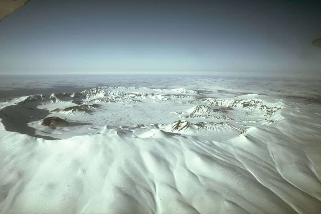
7. Kamchatka
At the far eastern tip of Russia, Kamchatka’s elevation is 4,750 meters (15,613 feet). The Kamchatka Peninsula in its entirety is approximately the size of Germany, Austria, and Switzerland combined. Over 400 glaciers and 189 volcanoes (29 active) exist in this region, with a stone birch forest at the lower elevations.
Most group treks are from June to September and are around seven days long.
8. Everest
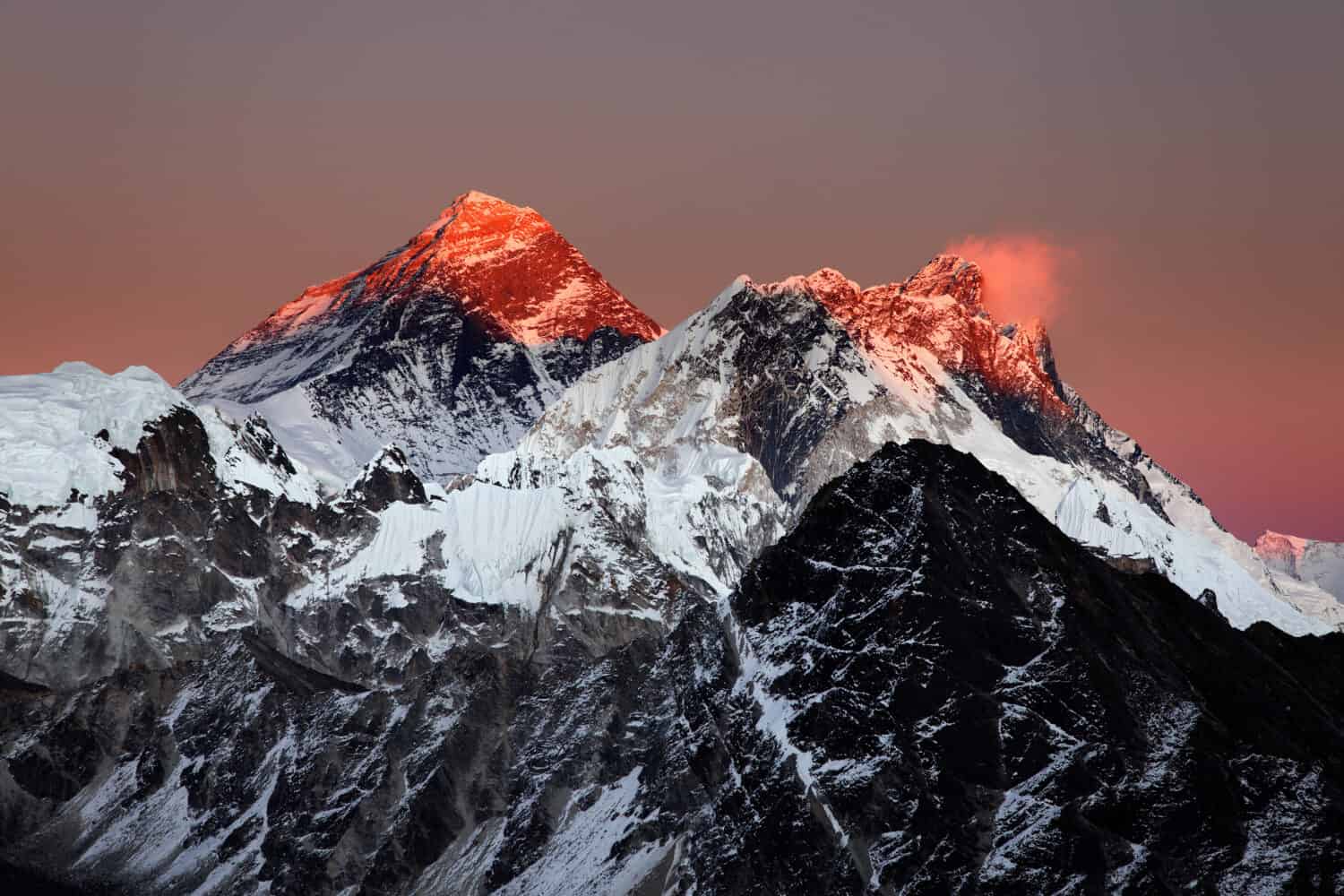
In the Himalayan mountain range between Nepal and Tibet, Mount Everest is an archetype of remote mountains. At an 8,848 meter (29,029 feet) elevation, the mountain reigns as the tallest point on Earth. Named after George Everest, a Surveyor General in India, Mount Everest was first summitted by British mountaineers in 1922.
Widely recognized as an extremely challenging and dangerous climb, even very experienced climbers have a difficult time completing the trek due to its treacherous terrain, extreme altitude, and ever-changing weather conditions.
9. Ojos Del Salado

Located in the Andes Mountains, Ojos Del Salado is the highest peak in Chile and the highest volcano on Earth. At 6,893 meters (22,614 feet) high, this mountain has dry and arid air which prevents the formation of glaciers or any consistent snow cover.
Most guides offer a 12-day excursion, and its climb is considered not technically too difficult until it is time to conquer its summit.
10. Mont Blanc
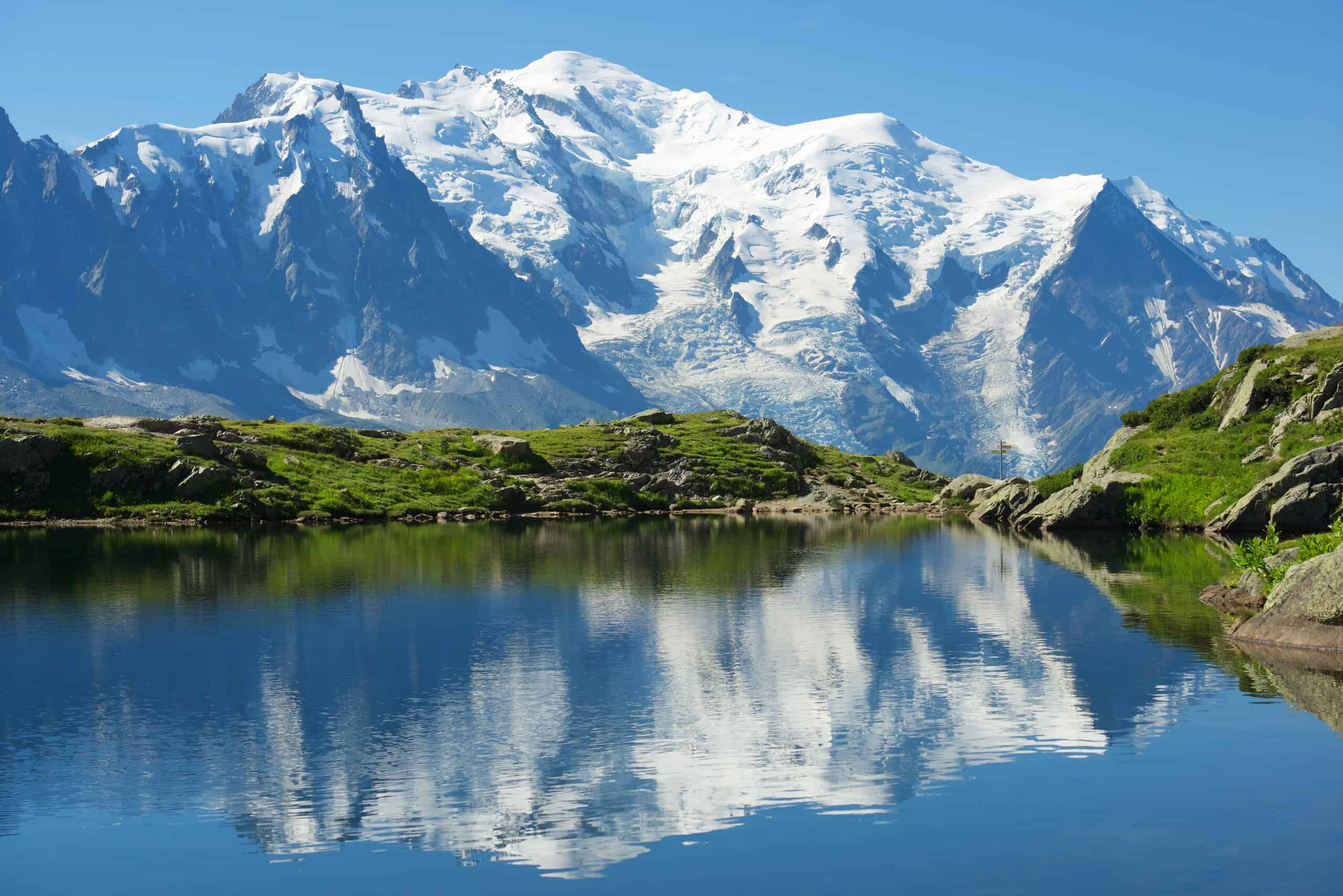
This mountain range (Massif du Mont-Blanc) lies in the Western Alps, mostly in France and Italy, but it also straddles Switzerland at its northeastern edge. At an elevation of 4,810 meters (15,781 feet), its name literally means “white mountain.”
There are many ways to trek the mountain range, but most prefer to tackle the main 105-mile stretch. Hikers enjoy amazing scenery such as lakes, rivers, mountains, glaciers, and plenty of wildlife. The area is a history lesson in itself with the 17th-century churches, buildings, and paths walked by Roman soldiers centuries ago.
11. Elbrus
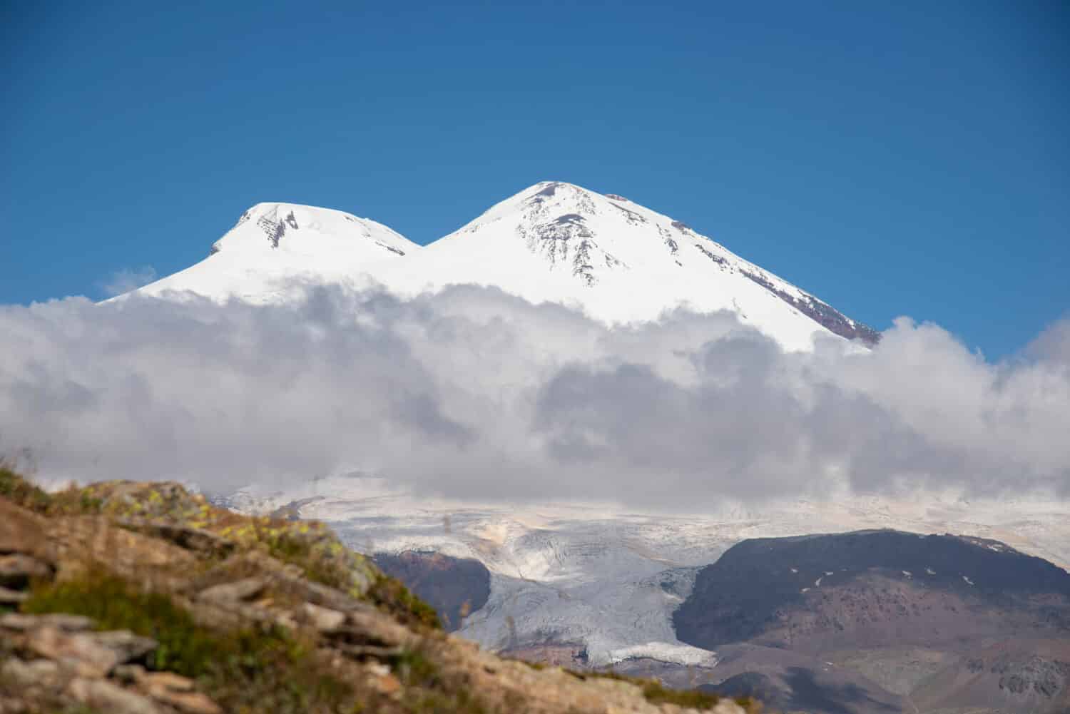
The highest mountain in Russia, Mount Elbrus possesses an elevation of 5,642 meters (18,510 feet). Located on the western edge of the Caucasus, this dormant volcano has two summits, with the western summit slightly higher than the eastern.
Most guided treks are about 12 days, with a minimum of eight days and at least three attempts at the summit. July and August are the optimum times to commence this journey, and this remote mountain is one of the few considered easy to moderate to tackle.
12. Whitney
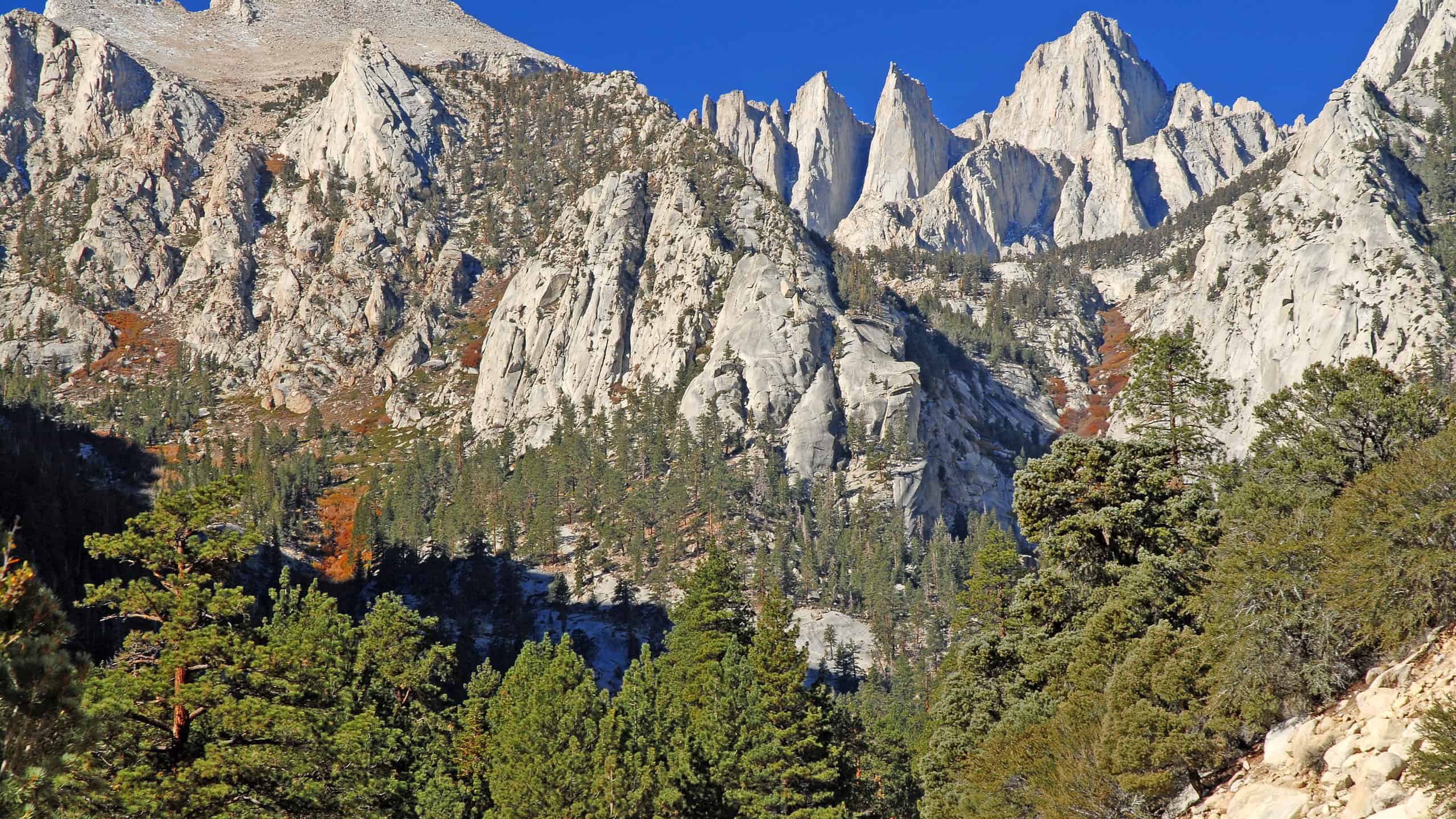
The highest mountain in the contiguous U.S. and the Sierra Nevada, Mount Whitney’s elevation is 4,421 meters (14,505 feet). It is situated in East Central California on the boundary of both Inyo and Tulare counties.
The mountain’s path is 21.5 miles, and it is considered a difficult hike. Most people tackle Mount Whitney as a day hike of 12-16 hours, but it can also be stretched to two to three days at a more leisurely pace. The topography is barren and rocky, but it is attainable for most seasoned climbers because it is not considered a technical hike.
13. Aoraki/Mount Cook
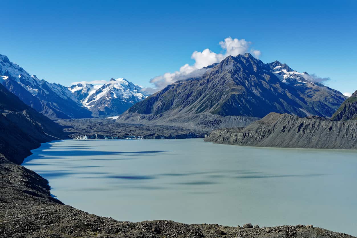
Sitting in the Southern Alps, Aoraki/Mount Cook’s elevation is 3,754 meters (12,119 feet). It offers three separate summits: the low peak from south to north, the middle peak, and the high peak. Throughout the year, the area enjoys breezy, moisture-heavy westerly winds that bring rain from the Tasman Sea.
Most hikers approach Mount Cook as a 12-16 hour day, but you can definitely make it an overnight trip. There is a 1,700-meter vertical climb, which hikers should not underestimate when planning their trek.
14. Tian Shan
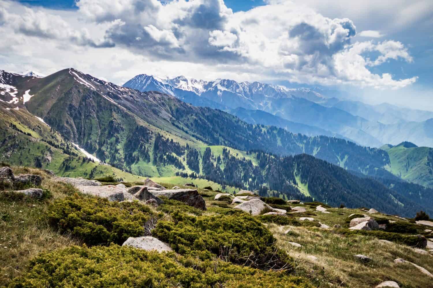
A large system of mountain ranges in Central Asia, the highest peaks in Tian Shan range from 5,500-6,000 meters (18,044-19,658 feet). The mountains straddle the border between China and Kyrgyzstan and bisect ancient Turkistan. Its alpine slopes are steep with glaciers along the crests. At lower elevations deciduous forests of maples and aspens mix with apple and apricot trees.
Many routes of hiking exist in Tian Shan, including a 28-mile three to four-day journey through the Ala-Kol Trek. Much longer hikes and climbs provide challenges for even the most expert of hikers.
15. Queen Mary’s Peak
Located in the South Atlantic Ocean at the summit of the island of Tristan da Cunha, Queen Mary’s Peak sits at an elevation of 2,060 meters (6,759 feet). A truly remote area, Tristan is the land that is farthest away from any other inhabited land. The closest inhabited place is St. Helena over 2,400 kilometers to the north.
To visit St. Mary’s, you are looking at a wait time of up to two years after you submit your application. By law, you must have an official guide lead you on the mountain as no rescue service exists. Frequent gales and storms impede claiming, and little variability exists as to the routes of ascent and descent.
| Mountain | Elevation |
|---|---|
| 1. Maunga Terevaka | 507 meters (1664 feet) |
| 2. Khüiten Peak | 4,374 meters (14,350 feet) |
| 3. Kilimanjaro | 5,895 meters (19,341 feet) |
| 4. Satopanth | 7,075 meters (23,211 feet) |
| 5. Aconcagua | 6,962 meters (22,941 feet) |
| 6. Belukha | 4,506 meters (14,783 feet) |
| 7. Kamchatka | 4,750 meters (15,613 feet) |
| 8. Everest | 8,848 meters (29,029 feet) |
| 9. Ojos Del Salado | 6,893 meters (22,614 feet) |
| 10. Mont Blanc | 4,810 meters (15,781 feet) |
| 11. Elbrus | 5,642 meters (18,510 feet) |
| 12. Whitney | 4,421 meters (14,505 feet) |
| 13. Aoraki/Mount Cook | 3,754 meters (12,119 feet) |
| 14. Tian Shan | 5,500-6,000 meters (18,044-19,658 feet) |
| 15. Queen Mary’s Peak | 2,060 meters (6,759 feet) |
Source: A-Z Animals